Introduction: The Paradox of Our Cosmic Ambitions
Humanity has crafted exquisite, high-resolution maps of the Moon, Mars, and Venus, yet we lack a basic topographical chart for the majority of our own planet’s seafloor. This contrast sits at the heart of a quiet scientific revolution: before we turn our primary exploration efforts toward the wider cosmos, we are deploying advanced deep-sea robots to map the bottom of Earth’s oceans. While space agencies command massive public attention and multi-billion-dollar budgets, oceanographers and engineers recognize that a fundamental understanding of our own blue planet remains a prerequisite for managing its future.
The Great Unknown: What We Are Missing Right Here on Earth
The surface of Earth is roughly 71 percent water, and the vast majority of that liquid volume plunges into perpetual twilight and pitch-black abyssal plains. For generations, maritime nations treated the ocean primarily as a surface highway for trade and a source of fisheries, leaving the bathymetry—the underwater topography—largely a blank slate. As of recent progress reports from initiatives like the Nippon Foundation-GEBCO Seabed 2030 Project, roughly 25 percent of the global ocean floor has been mapped with modern high-resolution bathymetric data. That leaves over 75 percent of the seabed completely unmapped by modern standards.
To put this in perspective, we possess more detailed maps of the Martian surface than we do of the planet we currently inhabit. Without accurate depth profiles and seafloor maps, scientists struggle to model ocean circulation, understand sea-level rise accurately, or predict how underwater topography steers major climate currents. The deep ocean is not an isolated, static desert; it is a dynamic engine driving global climate systems, yet we are navigating it blindly.
Why Space Gets the Glory (and the Budget)
Cultural momentum and historical context largely explain why the cosmos captured the public imagination long before the deep abyss. The mid-20th-century space race was fueled by geopolitical competition, dramatic rocket launches visible to the naked eye, and a clear, unifying national objective. Space exploration offered an ideological frontier that could be broadcast into living rooms worldwide via television.
Conversely, the deep ocean offered no such televised spectacle. Early ocean exploration relied on bulky cables, hazardous diving bells, and surface ships battling rough seas. Information retrieval was slow, and the environment was profoundly hostile to human presence. Space felt clean, luminous, and expansive, whereas the deep sea felt murky, claustrophobic, and terrifying. Consequently, public funding heavily favored astronomy and aerospace engineering over oceanographic research, creating a historical lag in marine technology.
The Extreme Environment: Why the Deep Sea Is Harder Than Orbit
Exploring the deep ocean presents physical barriers that make it, in many ways, technically more challenging than sending probes into the vacuum of space. While spacecraft must contend with extreme temperatures, solar radiation, and the vacuum of space, deep-sea probes face crushing hydrostatic pressure. At the deepest point of the ocean—the Challenger Deep in the Mariana Trench—the pressure exceeds 1,000 times standard atmospheric pressure at sea level. This is roughly equivalent to having about 50 jumbo jets pressing down on a single person.
Furthermore, water absorbs electromagnetic radiation quickly, rendering radio waves, GPS signals, and standard Wi-Fi useless beneath the surface. Spacecraft can beam data back to Earth via radio telemetry across millions of miles of empty space, but underwater robots must operate in near-total darkness without real-time satellite positioning. Every data packet, command, and navigation cue must reckon with an environment that swallows light and chokes off wireless communication.
Rise of the Machines: How Deep-Sea Robots Changed the Game
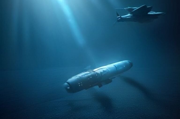
Over the past two decades, miniaturized sensors, improved battery chemistries, and advanced artificial intelligence have allowed engineers to bypass human physiological limitations underwater. Instead of sending fragile human divers into the abyss, marine scientists deploy a sophisticated fleet of robotic systems designed to withstand extreme environments.
| Robot Type | Primary Function | Operational Method |
|---|---|---|
| Autonomous Underwater Vehicles (AUVs) | Large-scale grid mapping and bathymetric surveys | Pre-programmed routes independent of surface vessels |
| Remotely Operated Vehicles (ROVs) | Detailed visual inspection and sample collection | Tethered to a surface ship via fiber-optic cable |
| Autonomous Surface Vehicles (ASVs) | Data relay, surface mapping, and acoustic tracking | Operates on the water line to manage communications |
These machines work in concert. A typical deep-sea mapping workflow relies on a structured sequence to gather data without putting human lives at risk:
Step 1 → An AUV is launched from a research vessel and programmed with a specific grid pattern to survey a target section of the seafloor.
Step 2 → The AUV sweeps back and forth, using onboard multibeam echosounders and side-scan sonar to ping the seabed and record depth data.
Step 3 → Upon completing its mission, the AUV surfaces, where its collected data is downloaded, processed, and checked for anomalies.
Step 4 → If a site requires visual verification or physical sampling, a tethered ROV is deployed to navigate directly to the coordinates identified by the AUV.
Practical Urgency: Why We Need Ocean Maps Now
Mapping the ocean is not merely an academic exercise driven by curiosity; it is an urgent requirement for planetary survival. Accurate bathymetric maps directly influence climate change mitigation strategies. Ocean currents, which regulate global heat distribution and absorb massive amounts of carbon dioxide, are heavily shaped by underwater mountain ranges, trenches, and continental shelves. Without precise maps of these underwater barriers, climate models have blind spots that reduce their predictive accuracy.
Coastal resilience and disaster preparedness also depend on these maps. When an underwater earthquake triggers a tsunami, the wave’s speed and height as it approaches land are dictated by the bathymetry of the seafloor it traverses. High-resolution maps allow emergency management agencies to run accurate computer simulations, providing vulnerable coastal communities with earlier and more reliable warnings. Furthermore, submarine telecommunication cables—which carry the vast majority of global internet traffic—rely on detailed seafloor maps to avoid hazardous underwater canyons, active faults, and abrasive slopes.
The Biodiversity Blueprint: Discovering Life in the Dark
Deep-sea mapping expeditions consistently reveal previously unknown ecosystems that challenge our understanding of biology. Hydrothermal vents—fissures on the seafloor spewing superheated, mineral-rich water—host complex communities of organisms that thrive entirely without sunlight, relying instead on chemosynthesis rather than photosynthesis.
These discoveries have immense practical value through bioprospecting. Microbes and organisms adapted to extreme pressure, heat, and toxicity often produce unique enzymes and chemical compounds. These biological assets have already yielded enzymes used in polymerase chain reaction (PCR) tests and show promise in developing new pharmaceuticals, industrial catalysts, and biodegradable materials. Mapping the ocean floor acts as a biological treasure map, cataloging life forms before industrial activities or climate shifts threaten them.
Parallel Frontiers: How Ocean Tech Feeds Space Exploration
The technological challenges of exploring the deep sea share a striking symmetry with the challenges of searching for life on other worlds. Astrobiologists regularly look to Earth’s deep ocean as a terrestrial analog for the icy moons of the outer solar system, such as Jupiter’s moon Europa and Saturn’s moon Enceladus. These distant worlds harbor subsurface liquid water oceans beneath thick crusts of ice, complete with potential hydrothermal activity.
Consequently, engineers testing autonomous robots in the crushing pressure, freezing temperatures, and total darkness of Earth’s deep sea are effectively dry-running the technology that will one day search for alien life. Guidance systems, obstacle-avoidance algorithms, and pressure-tolerant materials developed for deep-sea AUVs are directly transferable to interplanetary submersibles designed to melt through ice shells and explore alien oceans. Studying our own deep sea is, in a very real sense, an investment in extraterrestrial exploration.
Conclusion: Turning Our Gaze Inward to Safeguard Our Future
The push to map Earth’s oceans using advanced robotics is not a detour from our cosmic ambitions, but a necessary foundation for them. By treating the deep sea as a frontier demanding the same technological ingenuity we apply to space, we stand to gain vital climate data, unlock biological innovations, and build resilient infrastructure. Understanding the dark, crushing abyss of our own planet is the ultimate test of our readiness to explore the wider universe sustainably.
Frequently Asked Questions
How much of the ocean has actually been mapped?
As of recent progress reports from international mapping initiatives like the Seabed 2030 Project, approximately 25 percent of the global ocean floor has been mapped using modern high-resolution bathymetric data. This leaves more than 75 percent of the seabed unmapped in detail, meaning we have better topographical data for the surfaces of the Moon and Mars than we do for large portions of Earth’s own ocean floors.
Why is it harder to explore the deep ocean than outer space?
The primary barrier in the deep ocean is hydrostatic pressure, which increases dramatically with depth and requires immensely strong, expensive materials to prevent equipment from imploding. Additionally, water absorbs electromagnetic radiation quickly, rendering radio waves, GPS tracking, and wireless communication largely ineffective underwater. In contrast, spacecraft in the vacuum of space can easily transmit data across vast distances using radio telemetry.
What kind of robots are used to map the ocean floor?
Scientists primarily rely on Autonomous Underwater Vehicles (AUVs) to run pre-programmed grid patterns and map large areas of the seafloor using sonar. They also use Remotely Operated Vehicles (ROVs), which are tethered to surface ships via fiber-optic cables to provide live video feeds and collect physical samples from targeted underwater sites.
How does deep-sea mapping help fight climate change?
The ocean absorbs a significant portion of anthropogenic carbon dioxide and excess heat, circulating these elements through global currents shaped heavily by underwater topography. High-resolution maps of underwater mountains, trenches, and shelves allow scientists to build more accurate climate models, track heat distribution, and understand how the ocean buffers global temperature shifts.
Related reading
- Exploring the Hottest Planet in Our Solar System
- NASA’s New Rocket Built for the First Crewed Mars Mission
- Robots Are Now Running Marathons — How Do They Stay Upright?
- Inside the World’s First Robot-Run Farm: The Future of Agriculture
- Why 6G is Already Being Designed Before 5G Finished
- Inside the Race to Build a Working Quantum Internet
- How Space Debris Could Strand Us on Earth
- The Battery Breakthrough That Charges in 5 Minutes: EV Future
